Understand risk and resilience
Identify risk hot spots in your network or community
Visualise and report site-specific, area-specific, or an overview of risk to your infrastructure or community
Plan strategically for single and multi-hazard events both now and in the future
Plan and make informed decisions
Simulate events for emergency management preparedness
Test scenarios for effective risk reduction and adaptation
Justify interventions and future investment strategies
Empower further analysis for technical staff
Collaborate and engage effectively
Bring everyone along on the journey to building resilience
Make aligned decisions and collaborate across teams, agencies, or organisations securely with data sensitivity permissions for different stakeholders
Report, comply, and monitor
Effortlessly generate reports
Customise dashboards that can include broader risk reporting
Ensure compliance with legislative reporting requirements
Receive support, training, and frequent data updates throughout
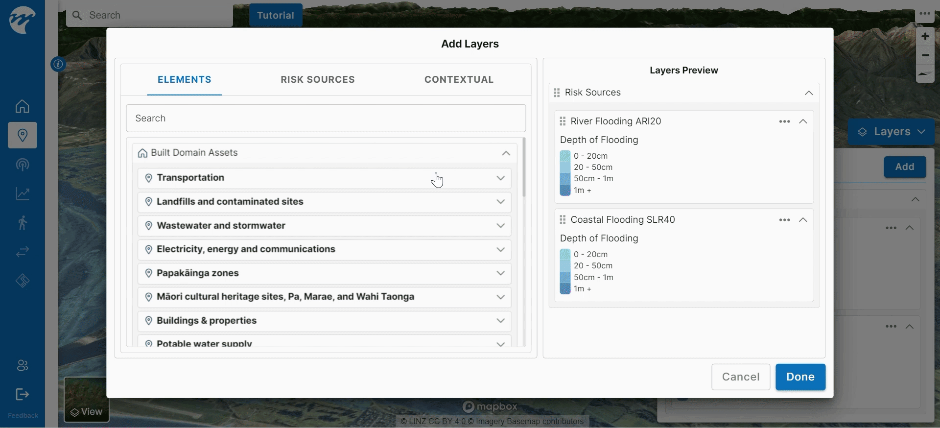
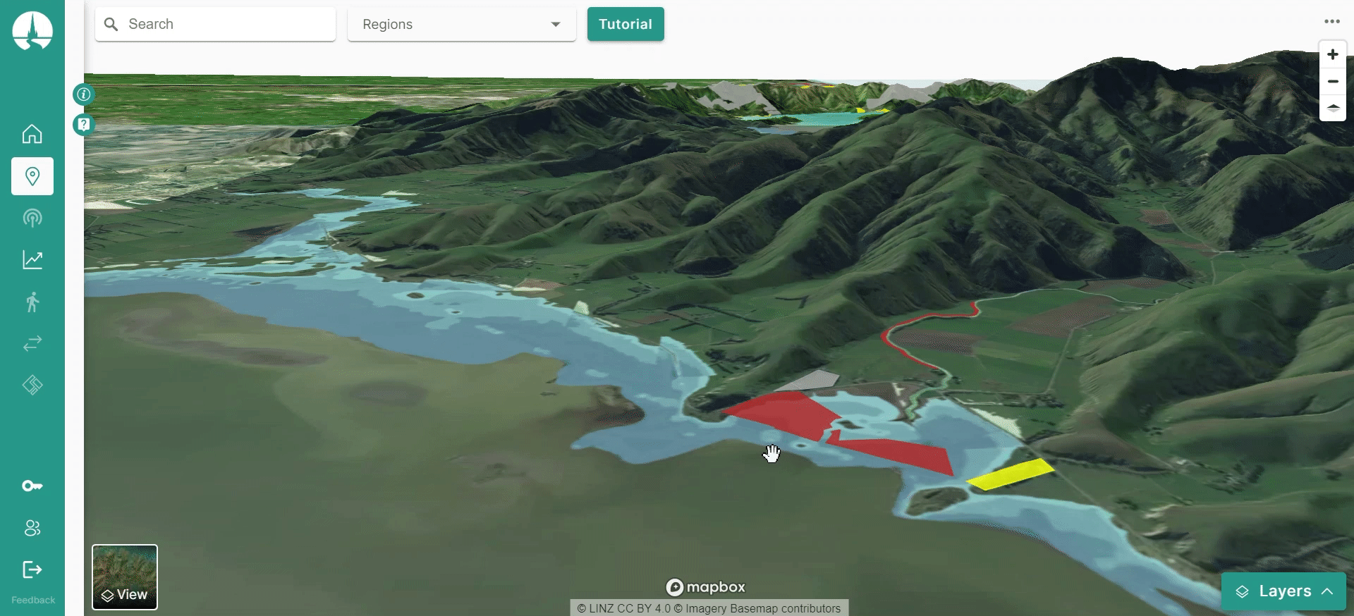
3D Scenario Viewer
Spatially explore your assets under multiple shocks and stressors both now, and in the future.
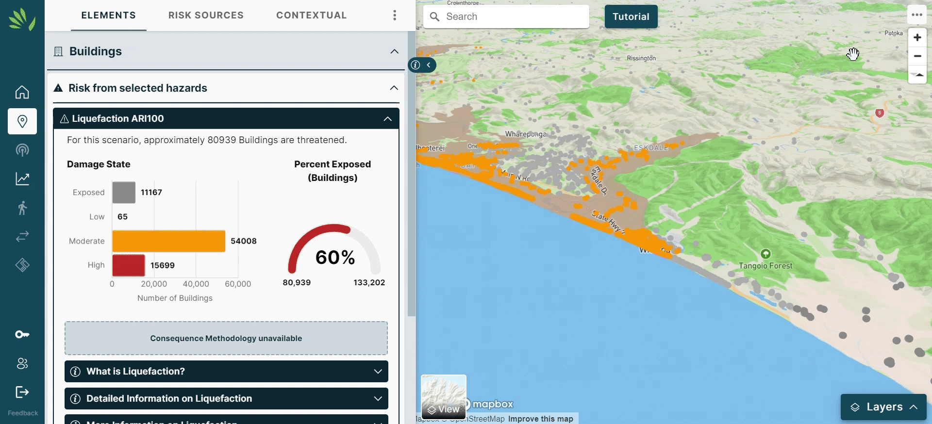
Direct Risk
Understand your exposure and estimated impact to different events.
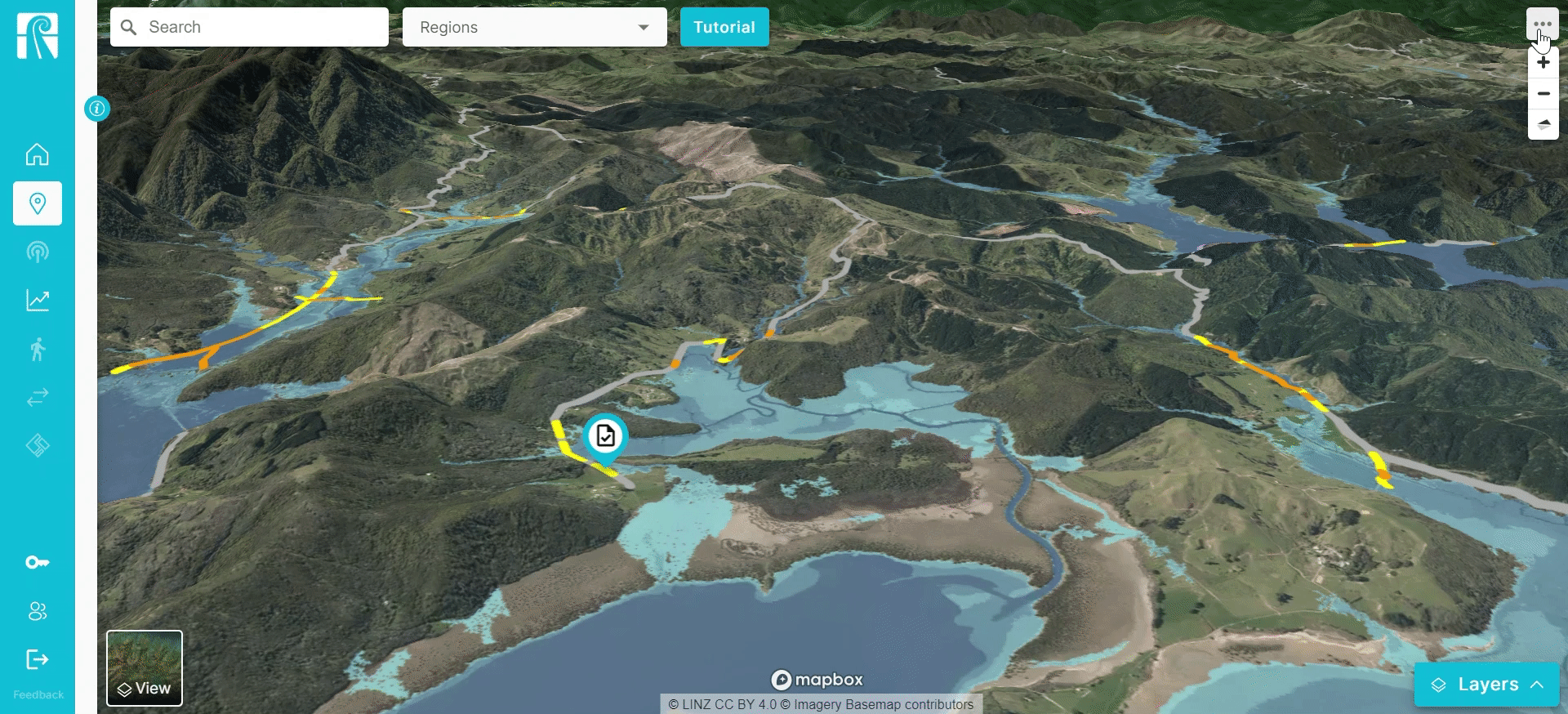
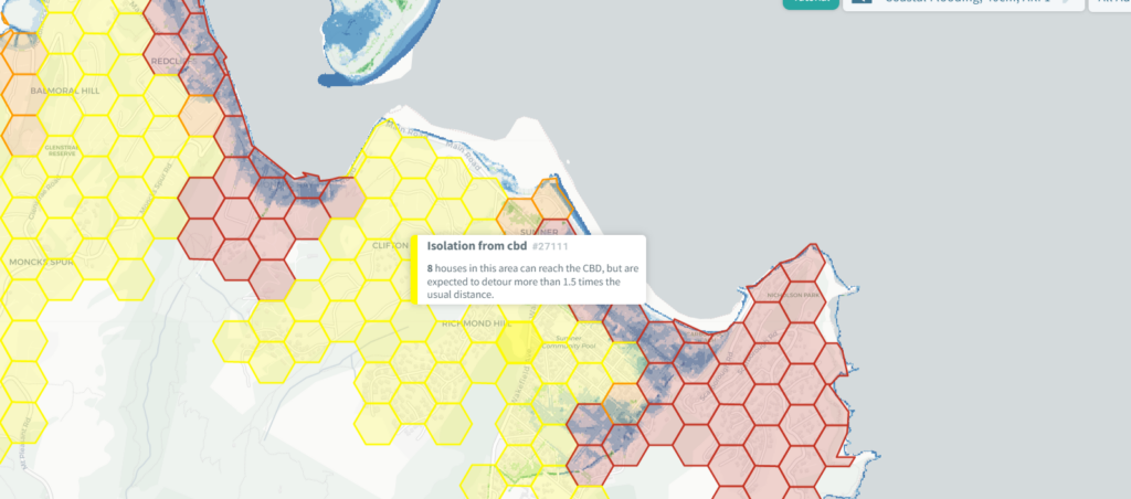
Area Level Statistics
Analyse the risk from multiple hazards at different spatial scales.
Custom Reporting
Utilise our suite of reporting options from risk registers, PDF exports, and risk statistics delivered at any resolution of your choosing.
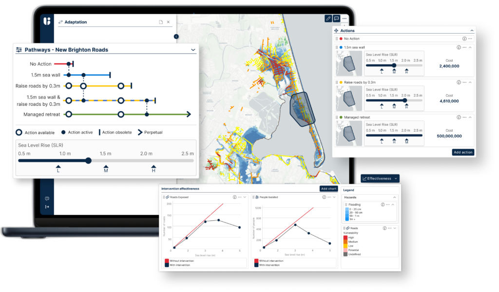
Intervention Testing
COMING SOON: Compare and contrast different adaptation choices from maintain, accommodate, protect, retreat, and avoid.
Indirect & Cascading Risk
COMING SOON: Leverage our world-leading research to evaluate and identify assets and communities that may be without power, water, sanitation, or access.
Join the growing number of Resilience Explorer users
Councils, businesses, iwi, infrastructure providers, community housing, emergency management, and central government. Hear from a few of our users below.

Jane Morgan
, Christchurch City Council

Paul Gilberd
, Community Housing Aotearoa
© Copyright 2024・Resilience Explorer, powered by Urban Intelligence. All rights reserved.